Day 9 (April 28, 2011)
Itinerary: Drive the Ring of Kerry
Today we drive the Ring of Kerry, known as one of the most spectacular and popular scenic drives in Ireland. The route is a 179km loop that goes out around the Iveragh Penninsula and back. We also tacked on the Skellig loop. The scenery was promised to be breathtaking with ocean views, lake views, mountains, and attractions along the way.
Luckily today we woke up to another gorgeous Ireland day with blue skies, a shining sun, and very little clouds. The temperatures climbed into the 60s today and I spent nearly the whole day in short sleeves. A perfect day for scenic views indeed!
We opted to drive in a clockwise direction and leave at 8:30 in the morning. The tour buses leave Killarney at 10:30 in the morning and move in an anti-clockwise direction. Though we’d have to pass them, it was still better too start in the opposite direction.
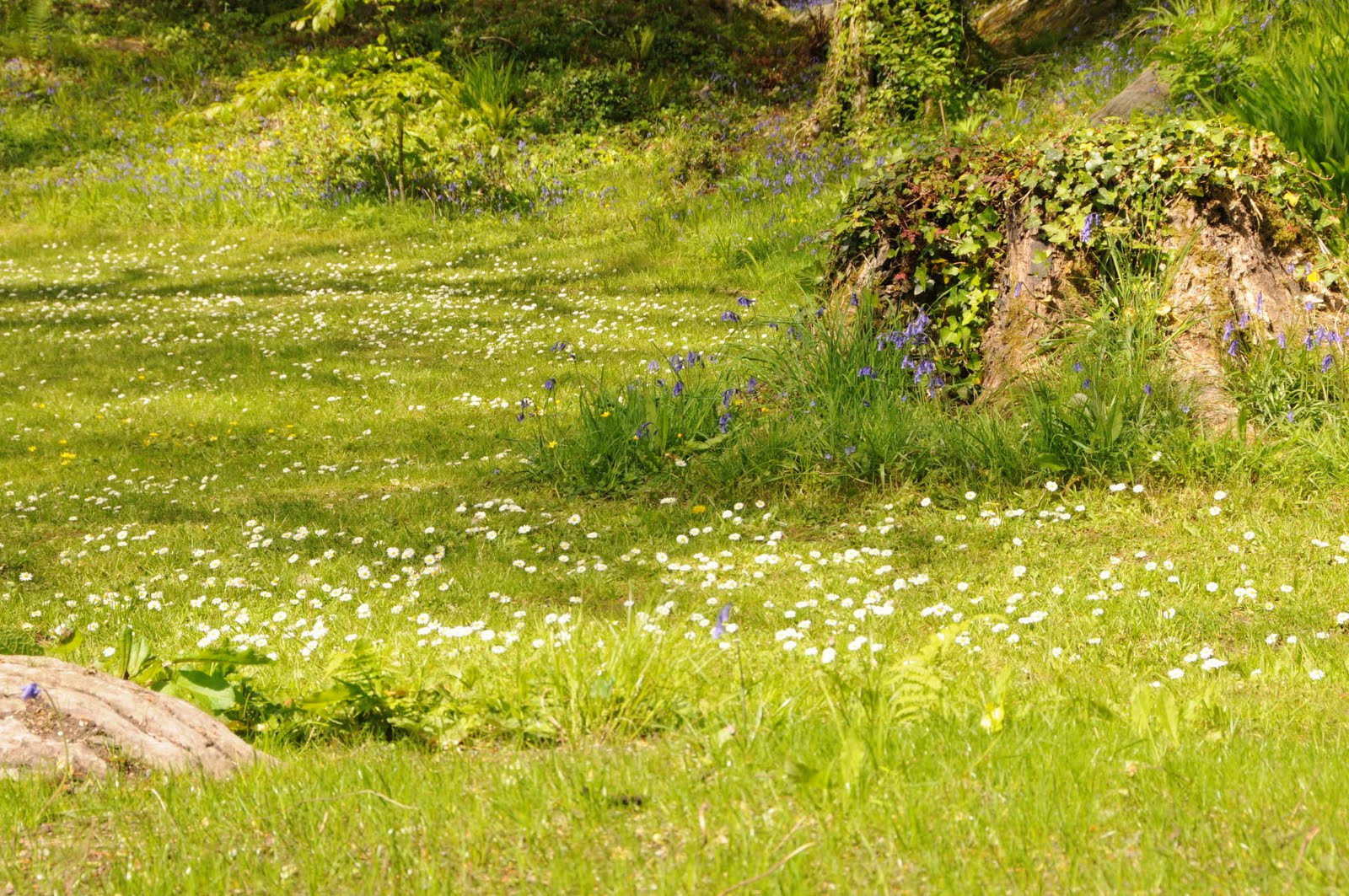
Our first stops were in Killarney National Park again. We noted that since we were here early in the day, the winds hadn’t kicked up yet and the lakes were dead still making for some amazing views. I very rarely see a still lake through my hiking travels, so this was a sign to behold. We pulled off a few times through the park and then ended up pulling off at Ladies View again to get the full effect of the view on a clear day. This viewpoint is named for the Queen’s ladies who would come up to this point from the Muckross House during her visit.
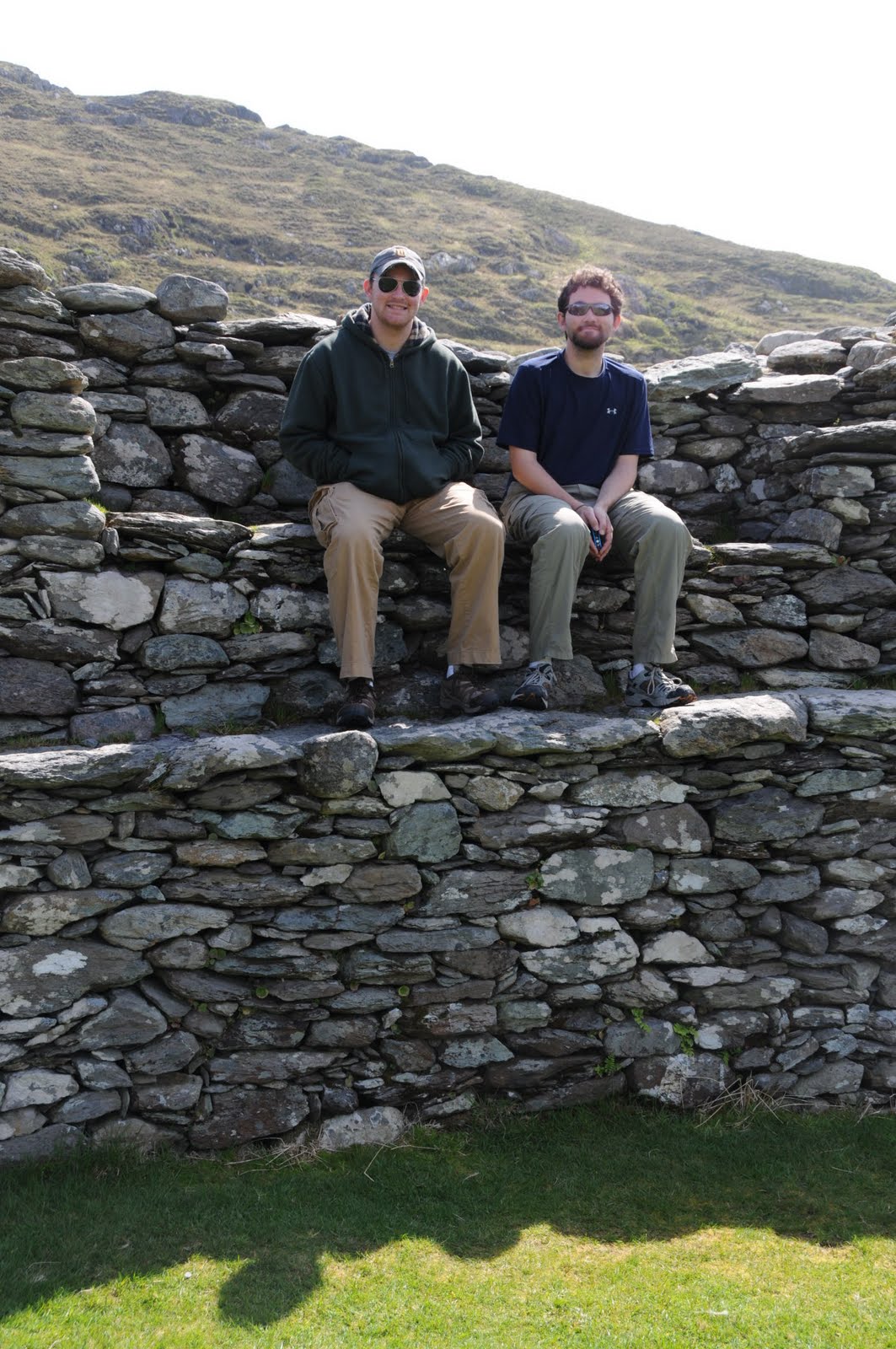
It would be nearly impossible to go through all stops we made today, but I’ll point out a few. We stopped at the Staigue Ring Fort. The ring forts have walls 12 feet (!!!) thick, made of stone (no mortar or cement) and built as early as 500 BC. They are circular and about 80 feet across and 20 feet high. Needless to say, this massive construction still hangs around today. No one is really sure exactly what they were used for, but the best guess is the people who built them would have retreated here at times of tribal war. The road to get to this fort is one lane lined with bushes and hedges and about 2.5km long. After needing to back up or pull out into the bushes several times along the ride, I was ready to get out of the car.
It took us 2 tries to find the Derrynane House, built as a hunting lodge and home of Daniel O’Connell, Ireland’s most influenced pre-independence politician. A self-guided tour of the house came with a 20-minute introductory video which was informative enough. Now I know who Daniel O’Connell is (basically he was a politician). The house was full of the period paintings and furniture. Most interesting was a carriage that O’Connell rode in when he was released from a brief stint in prison. The carriage was pulled by several horses and must have been at least 9 feet tall with a throne on top for him. Impressive indeed.
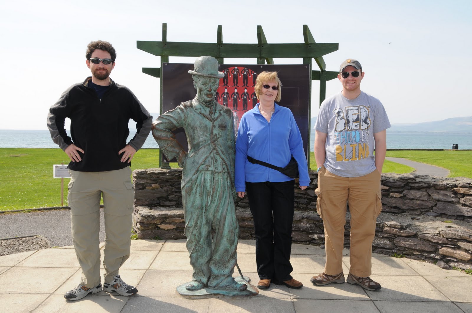
On our way to Waterville, which is down at sea level, we crossed Coomakesta Pass with it’s major pullout and viewpoint large enough for tour buses. Up here a local entrepreneur brought his lambs and dog up to sell photos to the tourists. It was windy on the pass, but the views over both bays. Waterville was home to Charlie Chaplin and his wife for some amount of time. This tiny town put up a sculpture of him right across from our lunch stop at a pub/restaurant. By now it was after 3pm and we were the only ones eating. They had good fish and chips, burgers, and fish burgers so we were happy. Across the restaurant was a little park and then views of the ocean. The sun was still shining happily down on us and we couldn’t ask for anything more.
Now we deviated off the Ring of Kerry to take the Skellig Ring Loop, a short extra coastal drive off the Ring of Kerry. On this drive we could see out to the Skellig Islands. These two tiny islands look more like triangles out in the ocean. Amazingly, they were inhabited for 600 years. There was no time for a boat ride out to see the islands. The smaller of the islands is home to thousands of birds and according to the guide book looks like it has been plummeted with a pillow due to all the feathers. The larger of the islands has a long stone staircase of about 700 stairs leading up to the ruins. I can’t imagine why anyone would want to live out there when the mainland of Ireland is so near, but to each his own.
Unfortunately the Skellig Chocolate Factory has been temporarily moved and we were unable to find it, so we continued on to Portmagee on Valentia Island. Before we crossed the bridge to the islands, we had to stop at the award-winning second best toilets in Ireland. We were not impressed. Mark rated them as – functional.
Across the bridge on Valentia Island we found out that the Skellig Experience Center was closed and only open in July and August. Oh well. We continued on to Knightstown – the only town on the island. Here we circled the city 2 or 3 times looking for the Knightstown Heritage Museum, but we never could find it. In a town with about 30 buildings, you wouldn’t think it would be hard to find a museum. We kept seeing signs, but never the building. Perhaps it was closed now this late in the day or only open in the summer anyway.
At this point to get back on the mainland of Ireland we had to take a tiny ferry ride across a small water crossing. The ferry ride was probably about 10 minutes in length if even that. The next stops were at two ring forts and a castle all very close together. Ballycarbery Castle was an excellent visit. Entrance required ducking under a barbed wire fence, but after that we were free to roam, scramble, and take photos. The castle it self is in ruins, but there are several staircases that lead to part of the second floor. The cows saw us coming and headed away while we scrambled around the ruins just like little kids would. I do love rock scrambling. These days I do less of this type of activity because I’m carrying a camera that would bonk into the rocks as I climb, but I didn’t let it stop me this time. There was lots of ducking under or over debris and some steep climbs on crumbling staircases. I loved this castle. Coming late in the day made for some excellent photo opportunities as the light was right and the green pastureland surrounding the castle added to the ambiance. The castle had ivy growing up the sides making it about the perfect looking old ruined site.
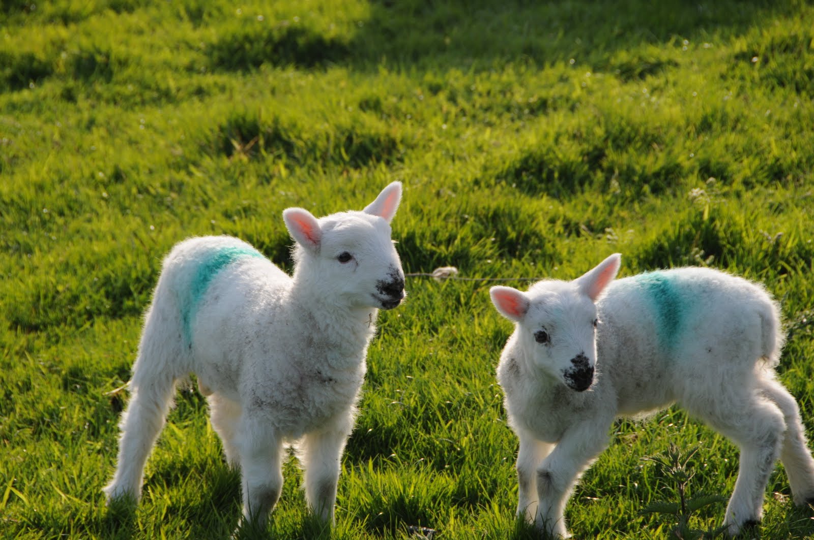
Finally we had our fill of pretending to be 10 again and headed down the road to the Cahergall and Leacanabuaile ring forts. The parking area off the side of the road was large enough for a couple cars and we were warned by hand painted signs to walk on foot from here on. The walks took us past the cows, horses, and donkeys. At one point, a donkey went absolutely crazy in the field down below. He was hee-hawing and running about. The sound carried well, and we all scrambled up to see what all the commotion was. Cahergall was the larger fort and had stone staircases leading up the wall much like the circles in Moray, Cuzco in the Sacred Valley of Peru. The steps weren’t the same, but both Mark and I were reminded of this Inca ruin when we climbed the various stepped levels in the Cahergall ring fort. Leacanabuaile was a smaller fort and seemed to have more of it’s ring banked up with soil rather than placed rock. We had fun climbing around this fort as well. Overall, these 3 locations provided a very fun way to end our Ring of Kerry tour and allow us to stretch our legs after sitting in the car for so many hours.
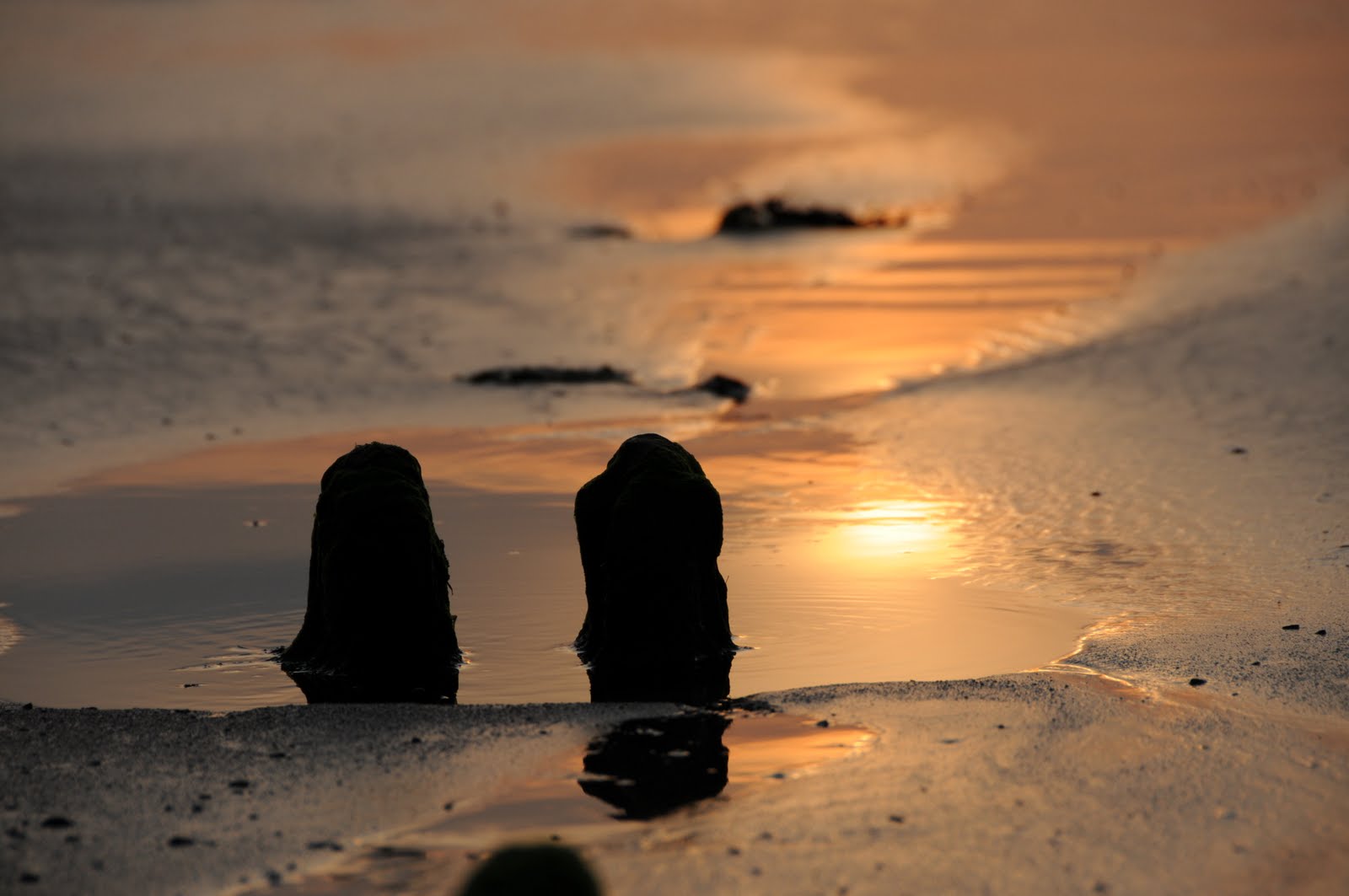
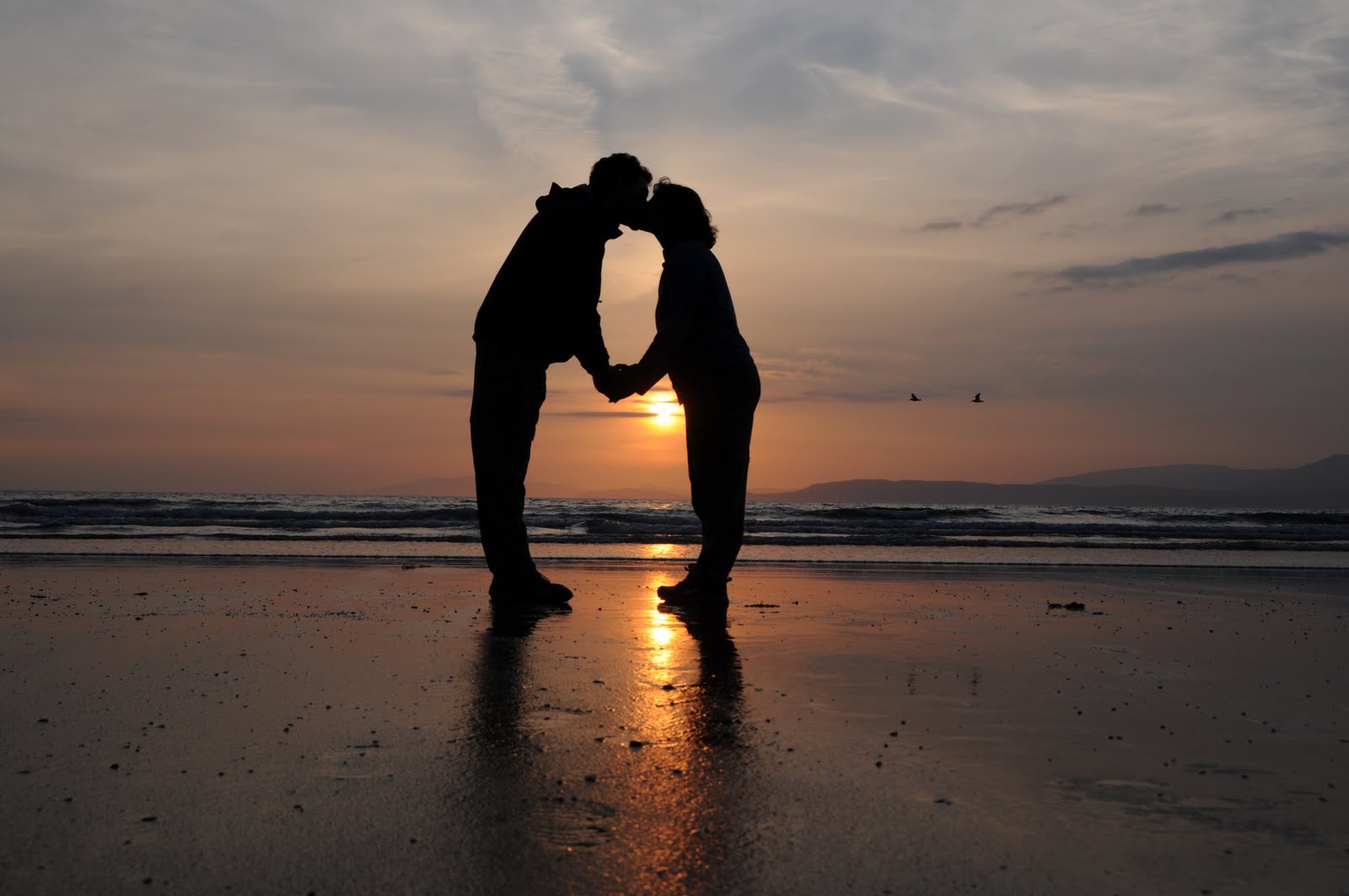
At this point, we basically drove with the scenery. It was after 7pm when we found the Bog Museum and there was no chance of it being open for us. The last stop of the day was a surprise to us as it wasn’t on the original plan. But after reading in one of our 4 tour books, we decided to visit Rosbeigh strand with it’s magnificent sand beach. We arrived with about half an hour to spare before the orange sun dipped beneath the horizon. The beach was long, wide, and flat. the high tide must have reached all the way to the rock wall holding the parking area, because all the sand was shimmering with the recent water, but the tide was far out and low. The photographic opportunities were endless here. I took advantage of the reflective sand and gorgeous colors in the sky to fill up my memory card.
Mark and I commented that we always seem to find a beach with a gorgeous sunset at some point on our vacations. The sun goes down around 8:45p here in the north part of the northern hemisphere, so we were well past the dinner hour by the time we got back on the road. Our 4pm lunch meant that we were not all that hungry anyway, so we simply drove back to our cottage and heated up the various leftovers we’ve saved over the week.
I think we were all glad to be out of the car. The Ring of Kerry is certainly one of the high points of anyone’s visits to southwest Ireland, and we couldn’t have asked for a better day. The warm temperatures (70ish), the sun, and the lack of wind made for one perfect day of scenic views.
Tomorrow we can have a lazy morning before spending the day back in Dingle to partake in the Pan Celtic Festival activities.
A slew of photos today to make up for the lack of photos for the past week.