Day 6 (February 7, 2011)
Itinerary for today: Visit the tourist center, Hike in the La Caldera area
It is always lovely to sleep in. We relaxed in the room and then on the rooftop terrace until about lunch time. While out in the sun, on the roof and on our balcony, the day felt nice and warm without a cloud in the sky. The breeze was still chilly, but the sun felt wonderful. It looks like a good day for hiking today.
The tourist office was finally open and we were able to score all kinds of useful information like maps, bus schedules, and the most important, a hiking map. The helper behind the desk spoke English and recommended that we head up the mountain a little ways away to La Caldera. It’s just on the end of the Teide National Park, I believe.
Over a tasty lunch at a nearby tapas bar, we studied the hiking and bus maps to find that we would probably have to wait quite a while for the bus to go up the mountain. Thankfully, the taxi ride up was inexpensive and took us right to the trailhead.
The area was full of hikers all decked out with hiking clothing, backpacks and trekking poles. They were all retired-age Germans. It was quite amusing to see such a large group of them, but it did make it feel similar to Switzerland. The area on this part of the mountain is treed and shady. We wore our fleece to stay warm, though the strenuous hike kept us pretty warm as well. The Germans seemed to be finishing their hikes and eating at the cafe while we were starting out. The trail was fairly empty of people. We found a great sign post with lengths and maps at the trail head. I was a little surprised at how well the trail was labeled. We found a decent route that included a one-way path to the town just south of us (with a bus stop) and also a loop that promised to give us the history to the water route.
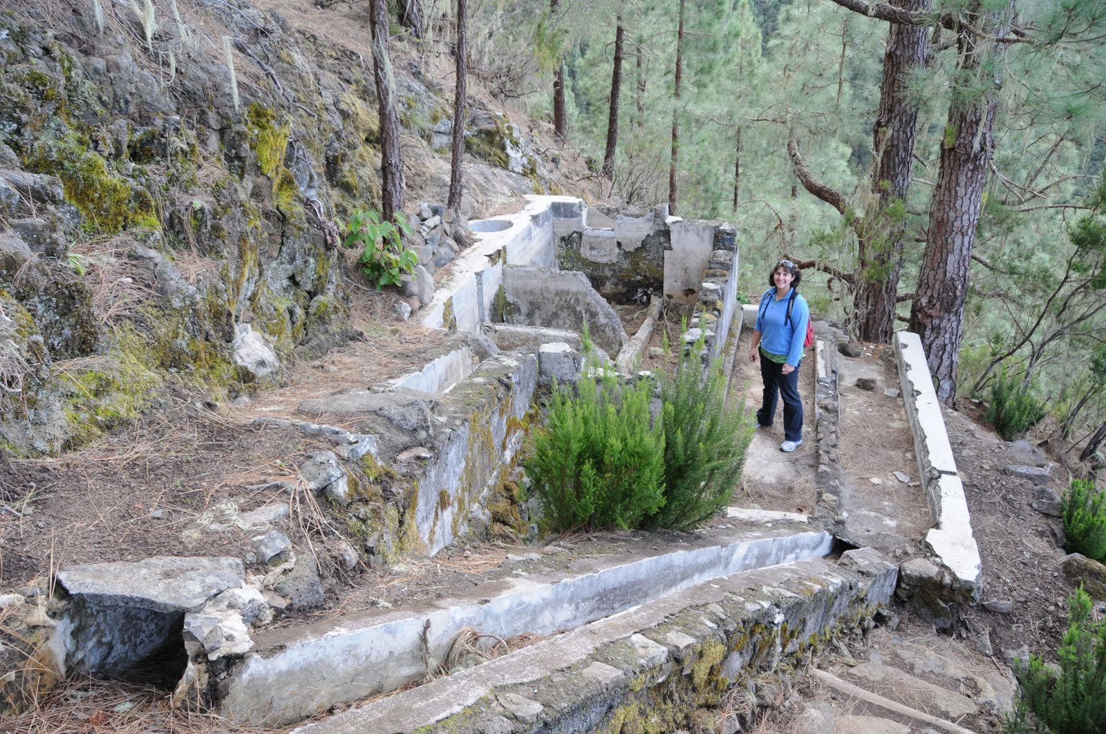
In total, we hiked about 5 miles. There were several spots that reminded me of the Inca Trail in Peru just due to all the steps, but we did get to see some great views of the valley and the coast below that held La Orotava and Puerto de la Cruz. We didn’t pass many people. Our first main stop was at the Casa Agua (or water house) where we could see inside an upper window that it had once held and routed water through the stone structure. On the loop hike, we followed an old aqueduct and found several structures that held and routed water along the way. The aqueduct was incredibly steep at 30-45 degrees in some places.
At the end of the hike we ended up just up the road from the bus stop with a bus about 5 minutes away. I don’t think we could have timed this any better. Back at the hotel we are killing time before dinner. While Mark plays Epic Mickey on the Wii, I’m typing up some blog posts.
Tomorrow is our first day that wasn’t booked before I left Houston. We’ve since decided to rent a car and drive up Teide mountain. We are going to stay 2 nights at the hotel up there and do hikes in the area. There is a cable car to the top of the mountain, and if we are lucky we can get a permit to be one of the 150 people per day to hike to the summit as well. Teide is the highest mountain in Spain.