Tuesday, June 25, 2013 (Day 7)
– 9p departed the guesthouse
– 10:45a Bjarnarfoss waterfall
– 11a Búðir church (black) and beach
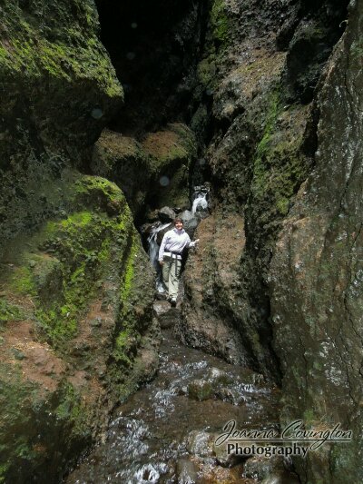
– 12p Rauðfeldargjá gorge hike
– 1p lunch at Arnarstapi
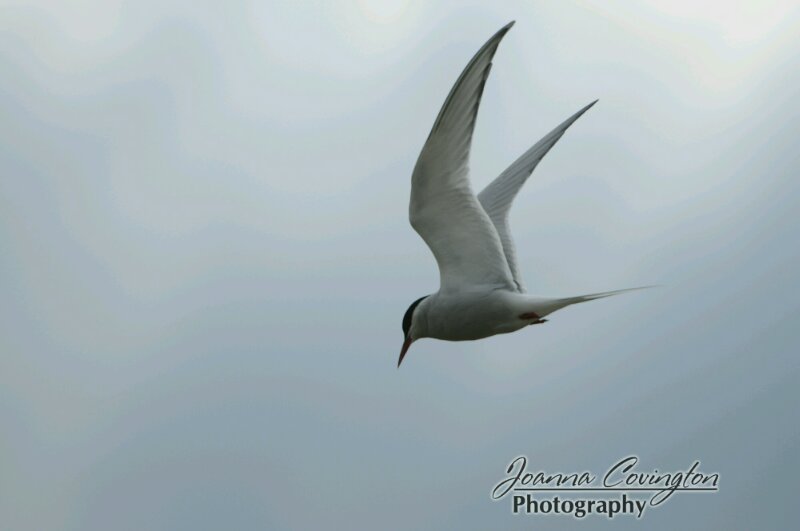
– 1:45p arctic terns after lunch
– 2:30p Malarriff coastline and Lóndranger basalt columns
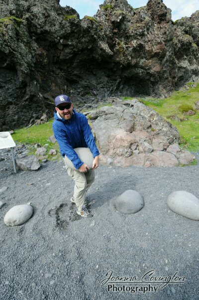
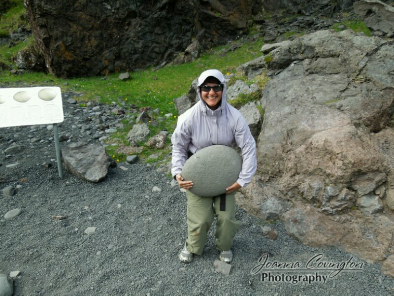
– 3:40p Dritvík beach stone lifting, and hike
– 4:30p drove into Berudalur crater
– 5:20p waterfall pictures at Mávahlið , artic terns attacked us
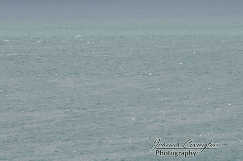
– 5:45p Kolgrafarfjörður fjord
– 6p completed loop of Snæfellsnes
– 6:40p islands in Breiðafjörður
– 7-8p crossed the base of the West fjords penninsula
– 9p dinner in Hvammstargi
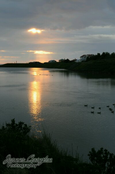
– 10/10:30p sunset photos near Blönduós
– 12:30a arrived at Hrafnagil
We had a pretty awesome day today even though there was lots of driving involved. For everyone that told me Iceland was small and 3 weeks was way too long to spend here, needs to come out and drive the Ring Road and then tell me you want to spend 2 months here instead! =) We are feeling a tiny bit rushed to see everything as most places to see are very spread out and there is a lot of driving to find the points of interest. No matter, we are up for the challenge!
We woke up early and to an early morning mist. We decided to skip a small hike in the Stykkishólmur area and get out on the road to drive the Snæfellsnes Peninsula. The peninsula was a full days worth of activities, and we planned to end the day in north Iceland in Akureyri! We wanted to get out of our guesthouse early as there was no room to do anything, so we drove down the road a bit and found a good place to have a picnic breakfast in our car overlooking a mountain and letting the mist fall around us.
We planned to take road 54 in a clockwise direction around the peninsula, so first we had to go back the way we came a bit, and drop south before heading out west along the southern portion of the peninsula. This was probably our first day of driving where we realized just how little traffic there was on the roads! We see a couple cars an hour or even less. There are a few pull outs, here and there along the road, but not always where I want them to be. So, with no cars around, I just stopped in the middle of the road when I saw a photo opportunity. I’ve even stopped, and then reversed down the road until I could get the right vantage point. Why can’t all my photo-drives be like this? This is awesome! With no shoulder to speak of, and yellow poles located about every 50 meters on the road, I also took to the Icelandic tradition of driving down the middle of the road most of the time, so I had enough space that I could oogle out the window at the incredible scenery passing by.
We stopped first at a very flat and reflective lake, but as soon as I got out of the car for photos, the tiny flies and bugs engulfed me and I could barely stand still enough for one photograph. Our first real stop was at a waterfall Bjarnarfoss on the side of the rocky face of a mountain far off from the road. We didn’t hike there, but I stopped for photos with my telephoto lens. So glad I brought this heavy lens with me! Apparently this area can get incredibly windy (though not so much today) and the wind can even blow the water up the mountain!
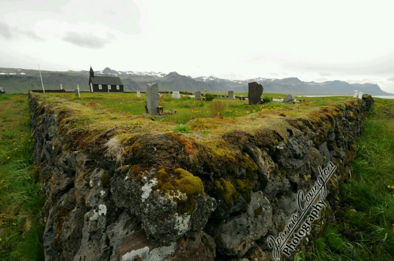
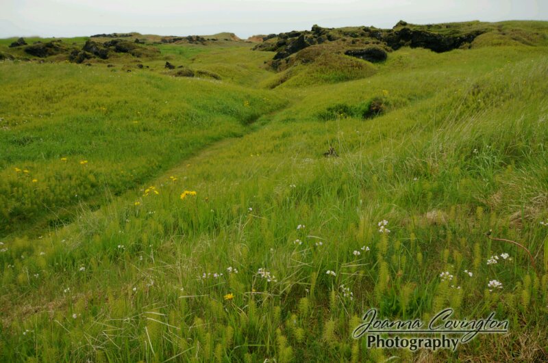
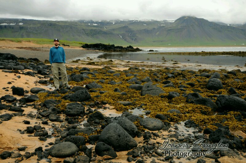
Next stop was at a very picturesque church in Búðir. The book even said to stop here and take a photo. There is nearly a church for every farm that we see as we drive around Iceland! They are all tiny, cute, and neat to take photos of. The churches in the bigger cities of over 1k people, however, are all of some very strange design. For this church, we got out of the car to walk around to the back and take photos, then I saw a little path leading away and towards the ocean. Here is where I could start to believe in the elves and hidden people. The location was just so pretty with vibrant, green grass, tiny flowers, rolling mounds on the ground like tiny hills, and lots of hidden little spots. I started looking around for fairies every time a butterfly flew past me. It was really just surreal. So, I kept following the path, every though I said I’d stop at the top of the next hill, I saw another place to photograph and look at. Then, we found ourselves at the ocean and spent a bit of time out there watching the birds, checking out the tidal pools, and generally just appreciating nature. I’m in love. I don’t have to drive any further!
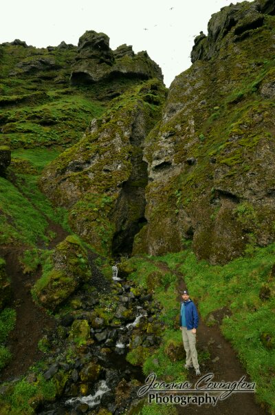
But, it was time to keep driving, and the next stop was at Rauðfeldargjá which didn’t look like much from the road, but 10 cars were parked here and everyone was out walking towards the mountain cliff face in front of us. So, we had to also! It turns out that we were hiking into a very narrow gorge full of birds. How neat was this! The walk from the car was uninteresting, but when we got close, we could see the thousands of birds circling above and nesting in the gorge. Then, one at a time we used the rocks as stepping stones, held onto the walls of the gorge, as they were just wide enough to put one hand on each side. Inside, there was a room that might hold about 20 people shoulder to shoulder, and then we walked up the river a bit more until there was no where else to go. Pretty cool. =)
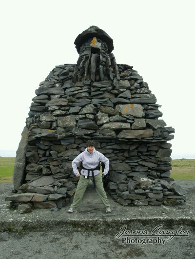
Our next stop in the town of Arnarstapi was mostly a lunch stop at a cafe. I was very happy with my leek soup and Mark was happy with his cheeseburger. Outside the restaurant was a large green field and our first real experience with the arctic terns. These birds are nesting now in large green fields, and they are so protective of their nests, that they actually dive bomb anything that comes within a certain range. I’d heard about the dive-bombing birds and the need for a hard hat in some areas, but I didn’t really believe it until we saw a man try to walk into the field a few steps and get attacked by the birds. It was right out of the Hitchock movie! Instead of stopping near this field, we drove out to a rock sculpture of a famous Viking and then walked out to the cliffs where a bunch of gulls were nesting in the cliff face overlooking the ocean. The cliff faces were pretty cool to look at on their own as they were built out of lava columns.
We had been told that the southern coast of the Snæfellsnes Peninsula has the best areas to stop, and this was indeed correct. We were spending the bulk of our time out here! We traveled on along the Malarrif coastline and stopped to look at the Lóndranger basalt columns, stopping to look and take photos. The next main stop, though was near Dritvík where we went on a several km hike along the cliffs and the beach. Along our hike, first we came to the four mighty lifting stones on Djúpalónsandur beach. Each stone has an individual name: the largest, fullsterkur (full strength) weighs in at 155kg, next comes hálfsterkur (half strength) at 140kg, then hálfdrættingur (weakling) 49kg, and finally amlóði (useless) weighing just 23kg. Any fisherman worth his salt had to be able to lift at least the latter two onto a ledge of rock at hip height to prove his strength. We were both able to just barely lift the “weakling” stone. After wearing ourselves out lifting stones, we hiked past the rusted remains of a shipwrecked trawler on the beach and then up across a lavafield out towards a beach with a rock we called “alligator rock.” We saw a variety of weather on our hike from sun to wind, to misty rain, and then back to sun.
After hiking and back in the car, we were now driving in the western most part of the peninsula and across wonderful old lavafields where we could really see the exact shape of how the lava flowed and cooled across the field. All the old lava rocks are now covered with a moss and lichen, and it was really beautiful. The whole purpose of coming out here, of course, was to also see the Snæfellsjökull (mountain and glacier in the middle of the western part of the peninsula) made world famous in the nineteenth century by Jules Verne’s Journey to the Centre of the Earth. With most of the cloud-cover of today we never really got to see the famous landmark until now where we could see it peaking out above the clouds a bit. We were driving in the sun, finally!
We were starting to feel the rush to move on off the peninsula and head up to Akureyri, so most of our next stops were short. We realized we could actually drive into a volcanic crater at Berudalur. Then, near Mávahlið, we pulled off the road to take a photo of a waterfall, only to find out we drove right next to an arctic tern field. We were attacked as soon as we got out of the car! I saw a bird dive bomb towards mark as we jumped back into the car and watch the birds attack the car! Then, I saw inside the car and took photos of the arctic terns instead! Around on the northern side of the peninsula now, we pulled off at the Kolgrafarfjörður fjord and stared in amazement as we could see the waters below speckled white with birds all floating around on the water! What a sight!
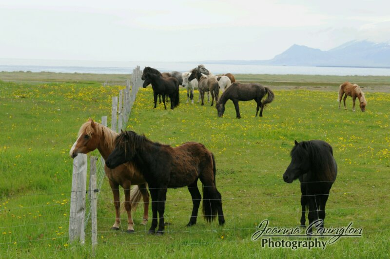
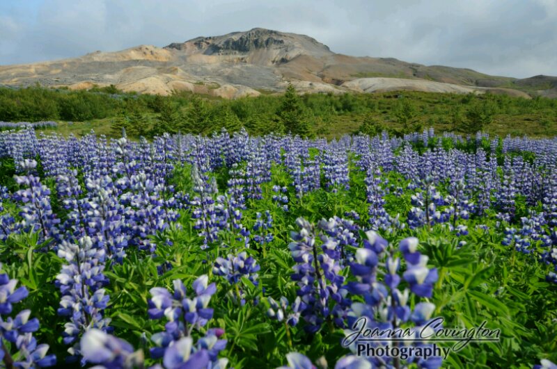
We concluded our peninsula driving tour, finally, at 6pm at the Drápuhlíðarfjall mountain made special because of the lighter color of the mountain. Once we stopped here to take photos of the mountain now that it was sunny and surrounded by alpine lupine, did we realized that this was the spot that we stopped at for breakfast, much earlier in the day! It looked so different now in the sun versus the cloudy, misty morning. We were back at the turn off for Stykkishólmur, and we took road 54 on across the base of the west fjords where the road turned into a long stretch of deserted gravel/dirt road. We stopped several times on the road for a photo here or there, but mostly we just continued on, admiring the Icelandic horses, the sheep, and the fact that we didn’t see a single other car for hours.
We did stop and admire Breiðafjörður as the bay was chock-full of neat islands. I wish we had more time to spend here. I also wished we had arrived earlier to Hvammstargi as apparently there was a whole seal colony in the area that you could take a boat trip out to see. We just barely got here in time to find out the only restaurant to eat at here was at the gas station. Gas station restaurants are more popular here in Iceland and they are much better quality than you would expect at a gas station. We were happy with our grilled sandwiches before we hit the road again. I emailed our farmstay guesthouse that we wouldn’t arrive until around midnight tonight and they promised to stay up for us.
In hindsight, I wish I would have told them we wouldn’t be arriving until around 3am, because we had the most amazing and longest sunset of our whole Icelandic stay on this night. However, we were driving with a time limit. =( We came down Ring Road 1, pointing north and realized the sky had been pink for nearly 5 hours already and the sun was a round, red ball on the horizon! Absolutely gorgeous! Here in north Iceland, sunset was about 12:40am and sunrise at 1:30am, so I should have just stayed here and gotten photos of both. We did briefly stop in Blönduós for some photos, but then hopped back in the car and reached our farmstay by 12:30am.

